
Vision
Vision is a collaborative mission support system designed to enhance coordination and tactical awareness during wildfire response operations.
COLLABORATION
TYPE
Software and hardware
Defense
When a wildfire doubles in size every 30 minutes, coordination can't wait for the radio to clear.
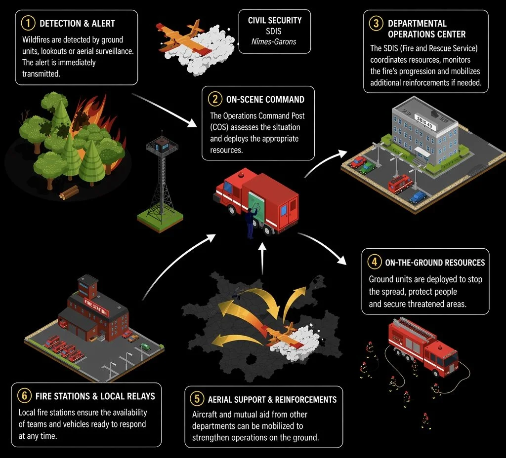
The French Response EcosystemSix actors.
Six vantage points.
One fire.
A pilot sees the fire as a moving shape in a landscape, through a cockpit wide-angle. A ground crew member sees smoke, a firebreak, a neighbor’s barn. The departmental command center sees weather fronts and resource flows.
There is no shared picture. Just voices on a radio, trying to translate what each one is looking at.
THREE FAILURE MODESWhere coordination breaks.
01
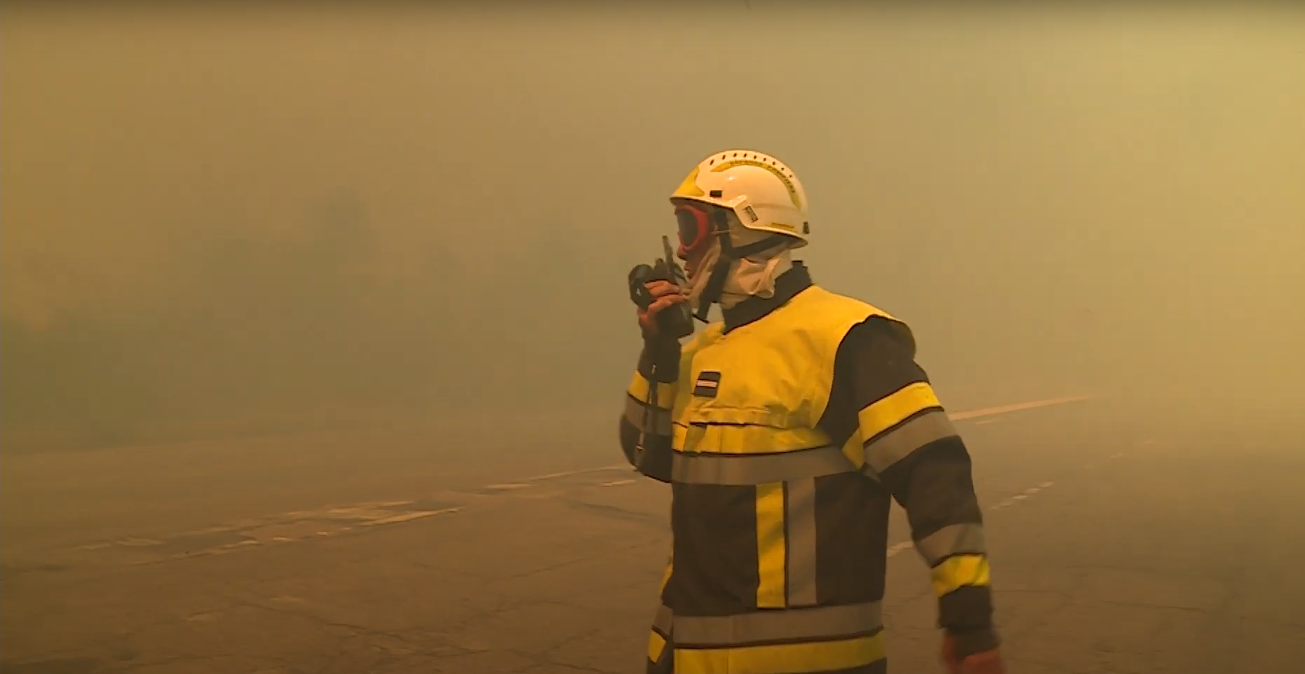
Radio is unreliable. And radio is all they have.
"There are often radio communication problems. We lose reception, and it creates a considerable workload."
BASTIEN — DASH PILOT · SÉCURITÉ CIVILECommunication between teams is primarily done via radio, often with poor reception and limited to verbal exchanges. In high-stress environments, this can lead to misunderstandings, delayed coordination, and information loss, especially when multiple actors are involved in dynamic and fast-changing situations.
03
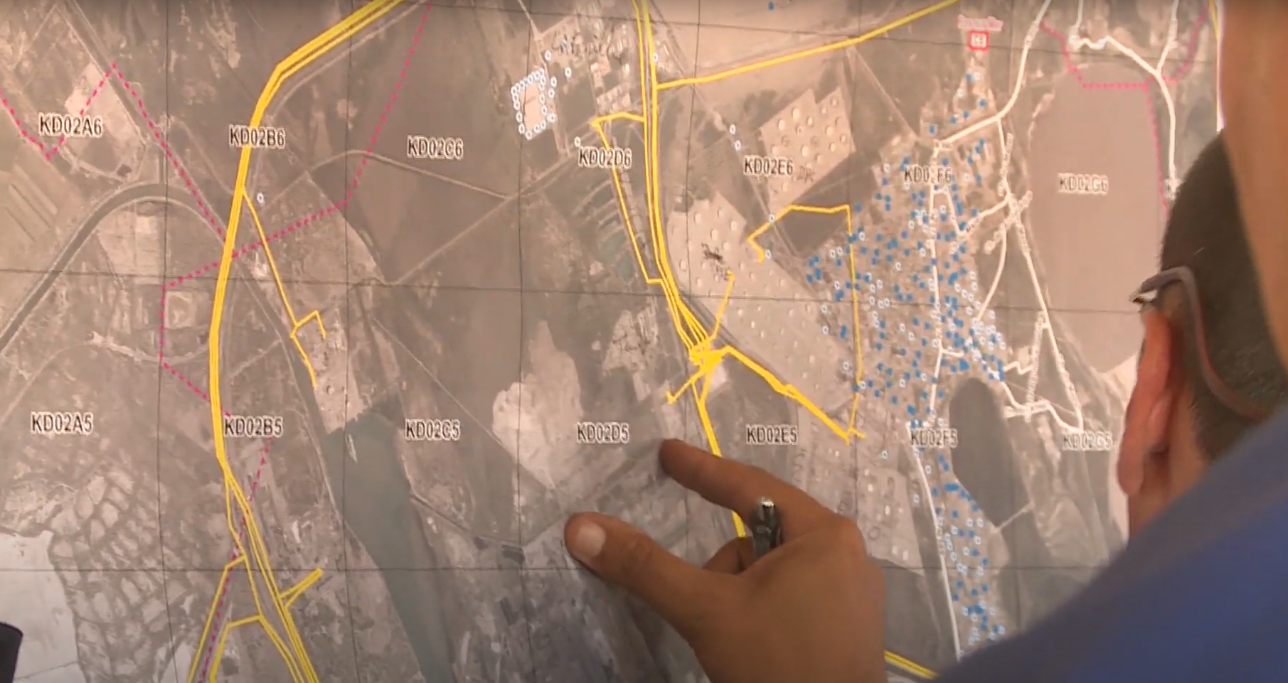
Lack of shared operational reference.
Different actors operate with different frames of reference. A pilot in a Canadair or Dash aircraft sees the landscape from a high-altitude, wide-angle view, while a ground crew member perceives the terrain at a very granular, local level. Without a common situational picture, aligning decisions and actions becomes difficult, often requiring manual verbal translation of spatial cues.
02
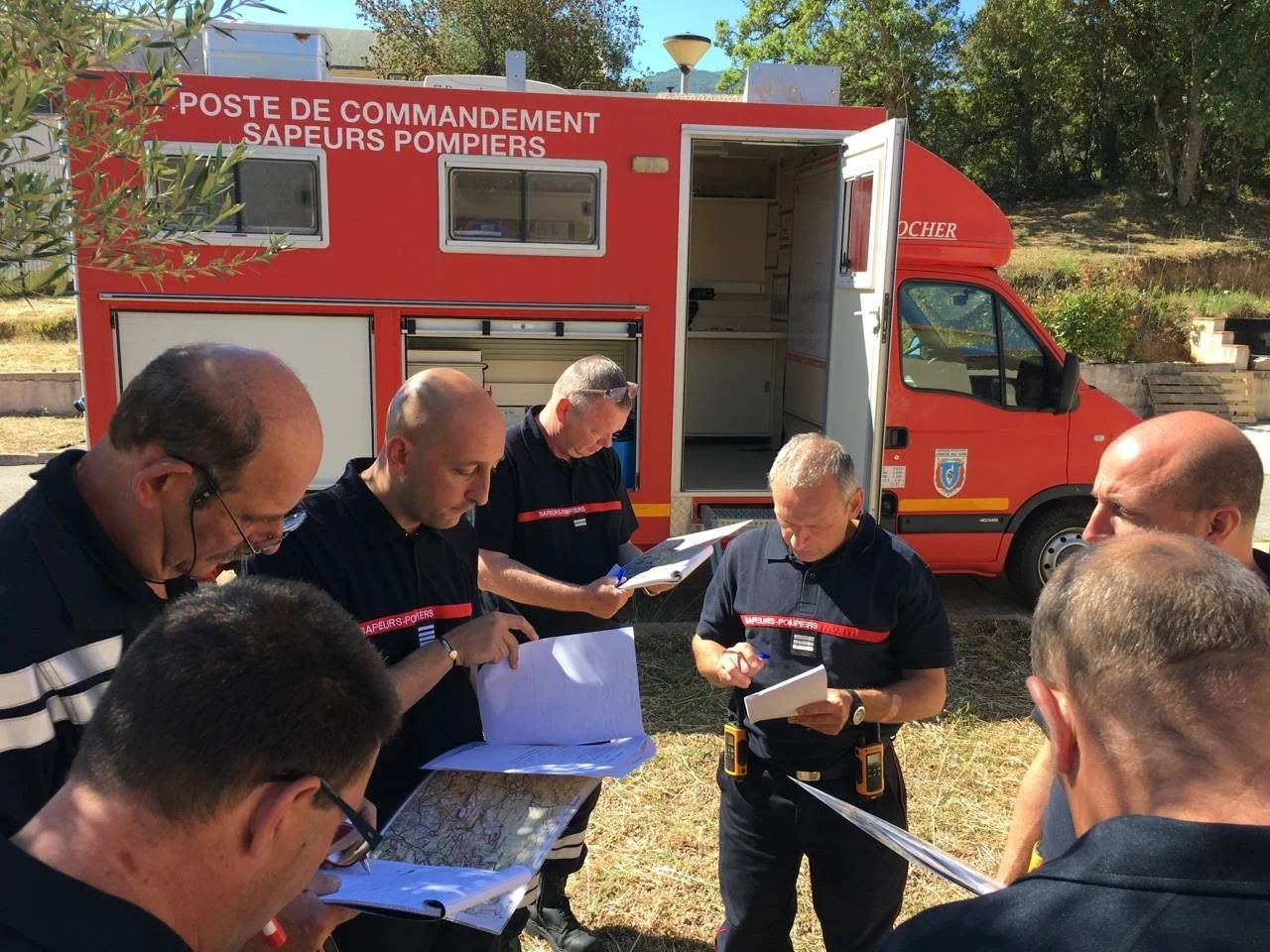
Mission planning still runs on paper.
Mission planning is still largely based on paper maps with mission-specific graphic codes. These tools are static, non-interactive, and not updated in real time. They don’t integrate critical changes such as evolving weather conditions, fire spread, or updated priorities, which limits situational adaptability and slows down decision-making.
How can we improve tactical situation awareness and support coordination between ground and aerial operators during wildfire response operations?
The design question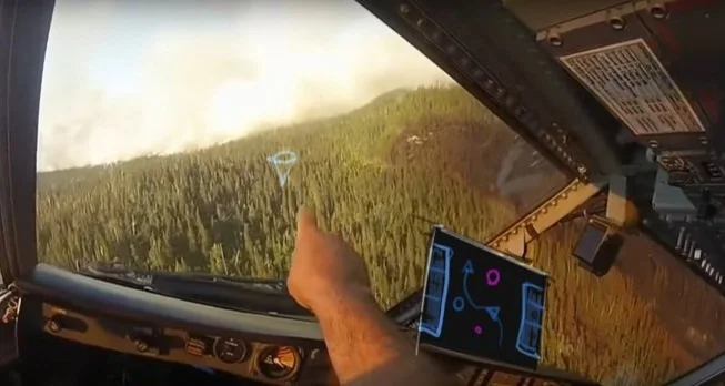
The solution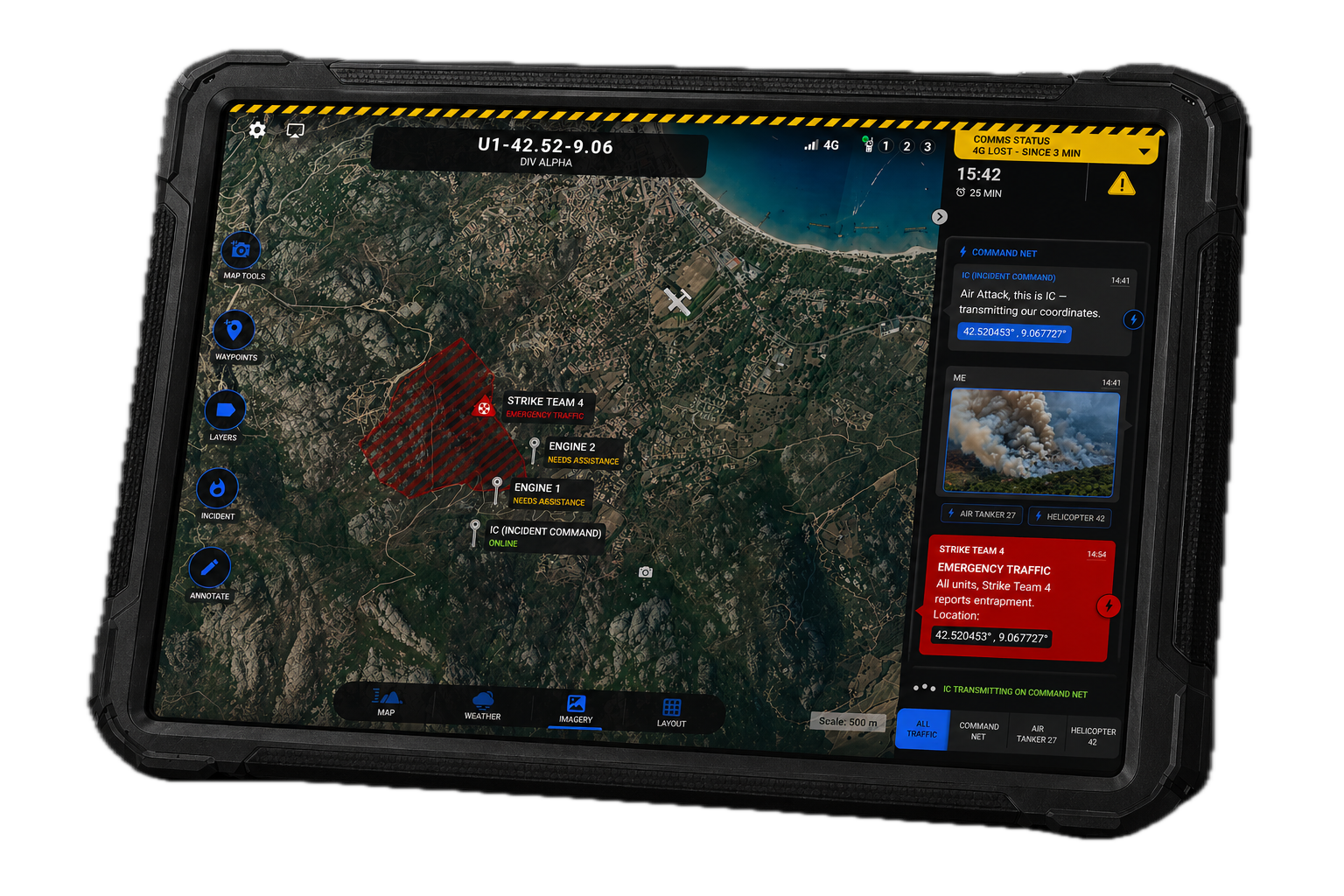

Vision is a collaborative tactical solution designed to support coordination during high-intensity wildfire operations. It connects ground and aerial teams through a shared digital interface, enhancing situational awareness, decision-making, and communication in the field.
It combines:
A collaborative map-based software
Connected objects (radio/audio capture modules)
A robust embedded system tailored to field constraints
🌟 Core Value Promises
Supports change management in field operations
All-in-one service: hardware, software & after-sales support
Plug-and-play deployment
Rugged and field-ready for extreme conditions
🔥 Designed for field realities
〰️
UI made for decision-making
〰️
🔥 Designed for field realities 〰️ UI made for decision-making 〰️
⚙️ How It Works
With a robust communication system
In the middle of a high-stakes aerial firefighting mission, two operators need to stay perfectly synchronized:
Operator A, the ground coordinator (COS), and Operator B, the helicopter pilot.
Each of them is equipped with a rugged tablet interface, designed for critical operations. These tablets are connected via the jack or lightning port to a radio communication module, a certified, secure device that bridges into the official firefighting radio network.
The voice messages received through the radio are processed in real time using Nuance’s voice recognition engine. Transcriptions are displayed directly in a chatbox within the UI and, when geolocation data is included, they are also pinned on the map, ensuring that no information is missed, even in noisy or high-stress environments.
But voice isn’t the only channel.
When network coverage allows it, the system also leverages cellular connectivity (3G/4G/5G) to enable data-rich exchanges between ground and air: shared maps, mission updates, alerts, and silent coordination messages are transmitted seamlessly.
The result?
A robust, multi-layer communication system that adapts to the context, ensuring operational continuity whether you're in radio-only zones or connected airspace.